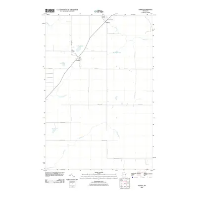
2010 Map of Kerrick
USGS Topo · Published 2010About this map
Kerrick and Duquette serve as the primary hubs in this northern Pine County landscape, where the local road network follows a rigid grid intersected only by the diagonal path of the regional highway. The area is defined by its abundance of water and recreational sites, including Anderson-Berger Park and Campground and several significant lakes such as Lake Margaret and Walthausen Lake.
Find a feature on this map
31 named features on this map. Tap any name to fly to it.
Don’t see what you’re looking for? This feature index may not catch every label — zoom into the map to look around manually.
Map Details
Editions of this 2010 Kerrick Map
This is the sole edition of this map. No revisions or reprints were ever made.
Other maps of this area

1949 · Danbury
USGS Topo · 1:48,000

1949 · Holyoke
USGS Topo · 1:48,000

1953 · Duluth
USGS Topo · 1:250,000

1958 · Duluth
USGS Topo · 1:250,000

1962 · Holyoke
USGS Topo · 1:62,500

1962 · Bruno
USGS Topo · 1:62,500

1962 · Cloverdale
USGS Topo · 1:62,500

1962 · Danbury
USGS Topo · 1:62,500

1980 · Sandstone
USGS Topo · 1:100,000
1981 · Askov Lookout Tower
USGS Topo · 1:24,000