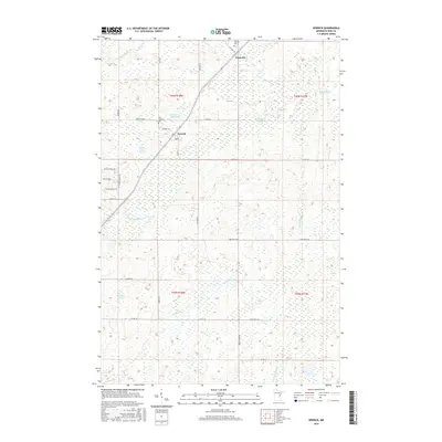
2016 Map of Kerrick
USGS Topo · Published 2016About this map
Duquette and Kerrick serve as the primary focal points in this northern Pine County landscape, where the iron-straight corridor of a major railway route cuts through a mosaic of wetlands and small water bodies. The geography is defined by the headwaters and tributaries of several drainage systems, including the Willow River and Little Willow River, which snake through the township lines of T45N and T44N. Local history and genealogy interest is anchored by the Saint Michaels Cem near Lake Margaret and the Catholic Cem north of Duquette. The road network, including Co Hwy 45 and numerous named rural routes like Knotty Pine Rd, reveals a pattern of scattered residential development and land management interspersed with named lakes such as Walthausen Lake and Bartels Lake.
Find a feature on this map
38 named features on this map. Tap any name to fly to it.
Don’t see what you’re looking for? This feature index may not catch every label — zoom into the map to look around manually.
Map Details
Editions of this 2016 Kerrick Map
This is the sole edition of this map. No revisions or reprints were ever made.
Other maps of this area

1949 · Danbury
USGS Topo · 1:48,000

1949 · Holyoke
USGS Topo · 1:48,000

1953 · Duluth
USGS Topo · 1:250,000

1958 · Duluth
USGS Topo · 1:250,000

1962 · Holyoke
USGS Topo · 1:62,500

1962 · Bruno
USGS Topo · 1:62,500

1962 · Cloverdale
USGS Topo · 1:62,500

1962 · Danbury
USGS Topo · 1:62,500

1980 · Sandstone
USGS Topo · 1:100,000
1981 · Askov Lookout Tower
USGS Topo · 1:24,000