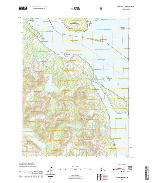
2021 Map of Ketchikan A-5 NE
USGS Topo · Published 2021About this map
The Tongass National Forest and Annette Island Reserve meet along the complex coastal geography of the Revillagigedo Channel in this remote Alaskan survey. The landscape is defined by its deep saltwater inlets and high coastal peaks, including Pop Mtn and Blunt Mtn. A network of islands and protected waterways, such as Hassler Harbor and the Cascade Inlet, provided vital maritime navigation routes between the larger masses of Annette Island and the mainland. Inland, the terrain rises sharply from sea level to over 2,000 feet, where alpine features like Tired Mtn look down upon freshwater basins like Cascade Lakes and Trout Lake. The map demonstrates the era's reliance on coastal access points like Harbor Point and Angle Point for movement throughout this largely roadless rainforest environment.
Find a feature on this map
34 named features on this map. Tap any name to fly to it.
Don’t see what you’re looking for? This feature index may not catch every label — zoom into the map to look around manually.
Map Details
Editions of this 2021 Ketchikan A-5 NE Map
This is the sole edition of this map. No revisions or reprints were ever made.
Other maps of this area

1949 · Ketchikan B-4
USGS Topo · 1:63,360

1952 · Ketchikan
USGS Topo · 1:250,000

1952 · Ketchikan B-4
USGS Topo · 1:63,360

1954 · Ketchikan B-5
USGS Topo · 1:63,360

1955 · Ketchikan A-4
USGS Topo · 1:63,360

1955 · Ketchikan A-5
USGS Topo · 1:63,360

1955 · Ketchikan
USGS Topo · 1:250,000

1955 · Ketchikan B-5
USGS Topo · 1:63,360
1991 · Ketchikan B-5 SW
USGS Topo · 1:25,000
1994 · Ketchikan B-5
USGS Topo · 1:63,360