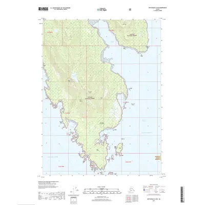
2017 Map of Ketchikan A-6 NE
USGS Topo · Published 2017About this map
Gravina Island dominates this portion of the Alexander Archipelago, characterized by a complex coastline of deep inlets and rocky outcrops. The southern tip is marked by Dall Head, a prominent landmark for navigation near the entrance to Nichols Passage. In the northern section, Flat Mtn and Chapin Peak provide significant elevation, with Downdraft Lake tucked between the interior ridges.
Find a feature on this map
27 named features on this map. Tap any name to fly to it.
Don’t see what you’re looking for? This feature index may not catch every label — zoom into the map to look around manually.
Map Details
Editions of this 2017 Ketchikan A-6 NE Map
This is the sole edition of this map. No revisions or reprints were ever made.
Other maps of this area

1948 · Ketchikan A-6
USGS Topo · 1:63,360

1952 · Ketchikan
USGS Topo · 1:250,000

1953 · Ketchikan B-6
USGS Topo · 1:63,360

1954 · Ketchikan B-5
USGS Topo · 1:63,360

1954 · Ketchikan B-6
USGS Topo · 1:63,360

1955 · Ketchikan A-5
USGS Topo · 1:63,360

1955 · Ketchikan
USGS Topo · 1:250,000

1955 · Ketchikan B-5
USGS Topo · 1:63,360
1991 · Ketchikan B-5 SW
USGS Topo · 1:25,000
1991 · Ketchikan B-6 SE
USGS Topo · 1:25,000