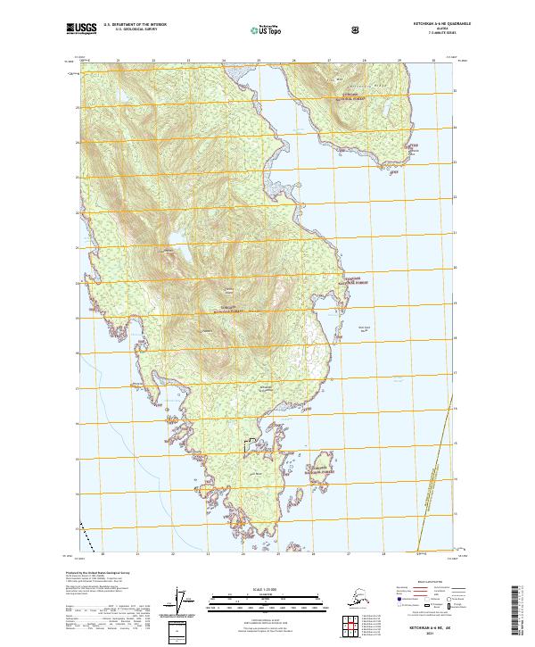
2021 Map of Ketchikan A-6 NE
USGS Topo · Published 2021About this map
Gravina Island dominates this maritime landscape within the Tongass National Forest, showing the intricate shoreline and mountainous interior of the Alexander Archipelago in recent years. The island's southern reaches are defined by a series of deep-water indentations including Nehenta Bay, Phocena Bay, and the protected waters of Dall Bay. High points such as Chapin Peak, Punch Hill, and the descriptively named The Puppets rise above the coastal flats, while the eastern shore faces the transit corridor of Nichols Passage.
Find a feature on this map
27 named features on this map. Tap any name to fly to it.
Don’t see what you’re looking for? This feature index may not catch every label — zoom into the map to look around manually.
Map Details
Editions of this 2021 Ketchikan A-6 NE Map
This is the sole edition of this map. No revisions or reprints were ever made.
Other maps of this area

1948 · Ketchikan A-6
USGS Topo · 1:63,360

1952 · Ketchikan
USGS Topo · 1:250,000

1953 · Ketchikan B-6
USGS Topo · 1:63,360

1954 · Ketchikan B-5
USGS Topo · 1:63,360

1954 · Ketchikan B-6
USGS Topo · 1:63,360

1955 · Ketchikan A-5
USGS Topo · 1:63,360

1955 · Ketchikan
USGS Topo · 1:250,000

1955 · Ketchikan B-5
USGS Topo · 1:63,360
1991 · Ketchikan B-5 SW
USGS Topo · 1:25,000
1991 · Ketchikan B-6 SE
USGS Topo · 1:25,000