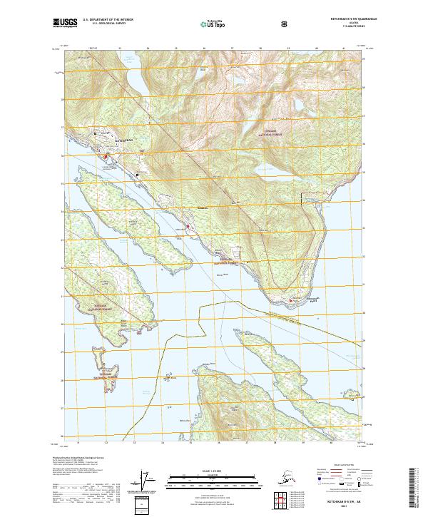
2021 Map of Ketchikan B-5 SW
USGS Topo · Published 2021About this map
Ketchikan and the neighboring community of Saxman occupy the narrow coastal strip along the Tongass Narrows, where the steep slopes of the Tongass National Forest meet the sea. This 2021 survey illustrates the modern layout of the city, showing institutional landmarks like the University of Alaska Southeast Ketchikan Campus and the Ketchikan Courthouse. The South Tongass Highway serves as the primary artery connecting these settlements to coastal points like Mountain Point and the small locality of Dairy.
Find a feature on this map
74 named features on this map. Tap any name to fly to it.
Don’t see what you’re looking for? This feature index may not catch every label — zoom into the map to look around manually.
Map Details
Editions of this 2021 Ketchikan B-5 SW Map
This is the sole edition of this map. No revisions or reprints were ever made.
Other maps of this area

1948 · Ketchikan A-6
USGS Topo · 1:63,360

1952 · Ketchikan
USGS Topo · 1:250,000

1953 · Ketchikan B-6
USGS Topo · 1:63,360

1954 · Ketchikan B-5
USGS Topo · 1:63,360

1954 · Ketchikan B-6
USGS Topo · 1:63,360

1955 · Ketchikan A-5
USGS Topo · 1:63,360

1955 · Ketchikan
USGS Topo · 1:250,000

1955 · Ketchikan B-5
USGS Topo · 1:63,360
1991 · Ketchikan B-5 SW
USGS Topo · 1:25,000
1991 · Ketchikan B-5 NW
USGS Topo · 1:25,000