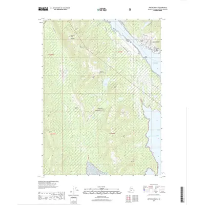
2017 Map of Ketchikan B-6 SE
USGS Topo · Published 2017About this map
Ketchikan stands as the primary urban center at the edge of the Alexander Archipelago in this modern survey. The map reveals the intricate maritime and aviation infrastructure necessary for this island-based community, featuring the Ketchikan International Airport on Gravina Island and its connection via the Gravina Island Access Road. Much of the interior terrain is defined by the steep slopes of the Tongass National Forest, where peaks like Sullivan Mtn and High Mtn overlook the waterways.
Find a feature on this map
45 named features on this map. Tap any name to fly to it.
Don’t see what you’re looking for? This feature index may not catch every label — zoom into the map to look around manually.
Map Details
Editions of this 2017 Ketchikan B-6 SE Map
This is the sole edition of this map. No revisions or reprints were ever made.
Other maps of this area

1948 · Ketchikan A-6
USGS Topo · 1:63,360

1952 · Ketchikan
USGS Topo · 1:250,000

1953 · Ketchikan B-6
USGS Topo · 1:63,360

1954 · Ketchikan B-5
USGS Topo · 1:63,360

1954 · Ketchikan B-6
USGS Topo · 1:63,360

1955 · Ketchikan A-5
USGS Topo · 1:63,360

1955 · Ketchikan
USGS Topo · 1:250,000

1955 · Ketchikan B-5
USGS Topo · 1:63,360
1991 · Ketchikan B-5 SW
USGS Topo · 1:25,000
1991 · Ketchikan B-5 NW
USGS Topo · 1:25,000