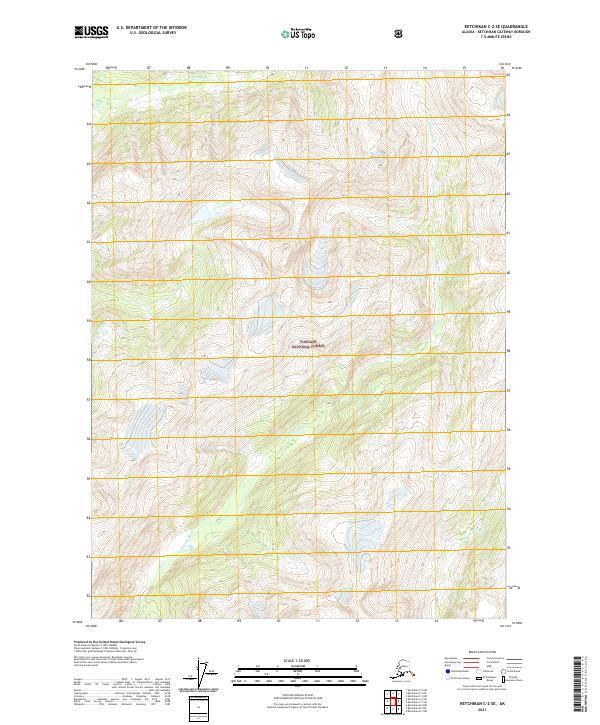
2021 Map of Ketchikan C-2 SE
USGS Topo · Published 2021About this map
Tongass National Forest dominates this topographic landscape, revealing a remote wilderness defined by its intricate drainage systems and steep elevation changes. Three major river systems carve through the terrain, with the Wilson River flowing across the northern reaches and the Blossom River winding its way through the central valleys. In the southeastern portion, the Keta River emerges, further illustrating the complex hydrological network of this coastal Alaskan region. The map provides a high-resolution view of the natural topography, including detailed contour lines that show the transition from valley floors to the high ridges typical of the area. As part of a 2021 survey, the document captures the exact boundaries of designated township and range sections, including t72s r97e, t72s r98e, t73s r98e, and t73s r99e, which serve as critical reference points for land management and ecological study within this protected forest environment.
Find a feature on this map
8 named features on this map. Tap any name to fly to it.
Don’t see what you’re looking for? This feature index may not catch every label — zoom into the map to look around manually.
Map Details
Editions of this 2021 Ketchikan C-2 SE Map
This is the sole edition of this map. No revisions or reprints were ever made.
Other maps of this area

1952 · Ketchikan
USGS Topo · 1:250,000

1955 · Ketchikan C-2
USGS Topo · 1:63,360

1955 · Ketchikan B-2
USGS Topo · 1:63,360

1955 · Ketchikan B-1
USGS Topo · 1:63,360

1955 · Ketchikan C-1
USGS Topo · 1:63,360

1955 · Ketchikan
USGS Topo · 1:250,000

1996 · Ketchikan C-2
USGS Topo · 1:63,360
2018 · Ketchikan B-2 NE
USGS Topo · 1:25,000
2018 · Ketchikan C-1 SW
USGS Topo · 1:25,000
2018 · Ketchikan B-2 NW
USGS Topo · 1:25,000