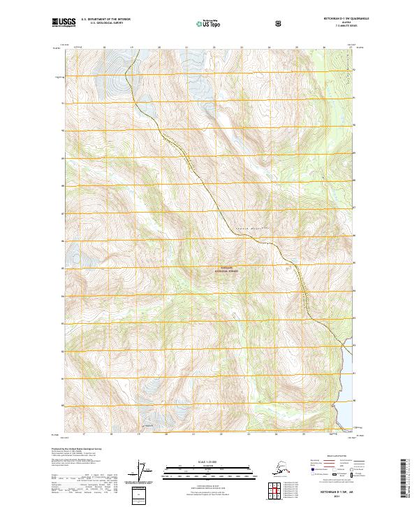
2021 Map of Ketchikan D-1 SW
USGS Topo · Published 2021About this map
Tongass National Forest dominates this Alaskan landscape, where the high peaks of the Lincoln Mountains and Seward Mountains define the hydrological divide. The Soule Glacier feeds the headwaters of the Soule River, which winds through the eastern portion of the quadrangle alongside the N Fork Soule River. To the west, the Davis River drains the steep slopes of the coastal range, including the prominent Mt Hayford. The map documents the boundary between the Prince of Wales-Hyder Census Area and Ketchikan Gateway Borough, illustrating a remote wilderness primarily defined by its glacial activity and dramatic vertical relief rather than human settlement.
Find a feature on this map
13 named features on this map. Tap any name to fly to it.
Don’t see what you’re looking for? This feature index may not catch every label — zoom into the map to look around manually.
Map Details
Editions of this 2021 Ketchikan D-1 SW Map
This is the sole edition of this map. No revisions or reprints were ever made.
Other maps of this area

1952 · Ketchikan
USGS Topo · 1:250,000

1955 · Ketchikan D-2
USGS Topo · 1:63,360

1955 · Ketchikan C-2
USGS Topo · 1:63,360

1955 · Ketchikan D-1
USGS Topo · 1:63,360

1955 · Ketchikan C-1
USGS Topo · 1:63,360

1955 · Ketchikan
USGS Topo · 1:250,000

1996 · Ketchikan C-2
USGS Topo · 1:63,360
1996 · Ketchikan D-2
USGS Topo · 1:63,360
2018 · Ketchikan D-2 SE
USGS Topo · 1:25,000
2018 · Ketchikan C-1 NE
USGS Topo · 1:25,000