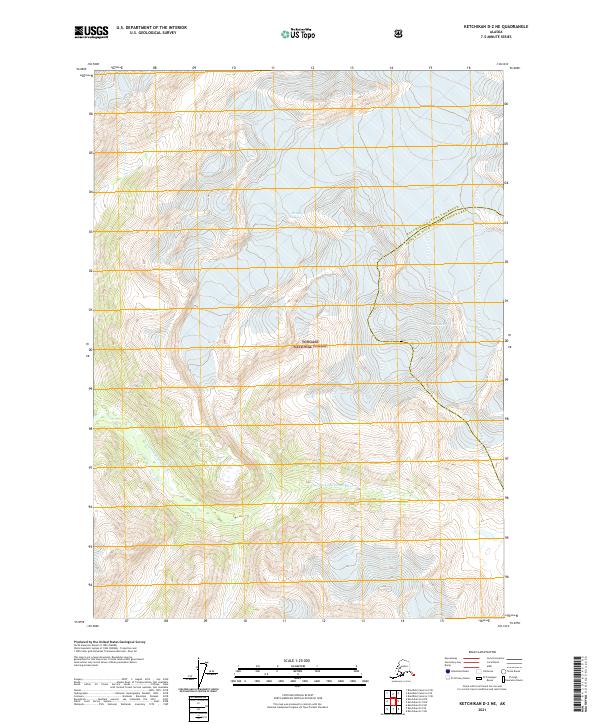
2021 Map of Ketchikan D-2 NE
USGS Topo · Published 2021About this map
Tongass National Forest dominates this Alaskan landscape, where glacial movement and river systems define the high-latitude terrain. The southern portion of the map is shaped by the S Fork Chickamin River, which carves through narrow valleys between steep ridges. The drainage patterns and topographic relief here illustrate the raw hydrological character of the region, providing a baseline for environmental study and resource management within the national forest system.
Find a feature on this map
8 named features on this map. Tap any name to fly to it.
Don’t see what you’re looking for? This feature index may not catch every label — zoom into the map to look around manually.
Map Details
Editions of this 2021 Ketchikan D-2 NE Map
This is the sole edition of this map. No revisions or reprints were ever made.
Other maps of this area

1951 · Bradfield Canal
USGS Topo · 1:250,000

1952 · Ketchikan
USGS Topo · 1:250,000

1954 · Bradfield Canal
USGS Topo · 1:250,000

1955 · Ketchikan D-2
USGS Topo · 1:63,360

1955 · Bradfield canal A-2
USGS Topo · 1:63,360

1955 · Bradfield Canal A-1
USGS Topo · 1:63,360

1955 · Ketchikan D-1
USGS Topo · 1:63,360

1955 · Ketchikan
USGS Topo · 1:250,000

1955 · Bradfield Canal
USGS Topo · 1:250,000
1996 · Bradfield Canal A-1
USGS Topo · 1:63,360