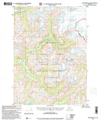
1996 Map of Ketchikan D-2
USGS Topo · Published 2000About this map
Tongass National Forest dominates this Alaskan landscape, where the glacial influence on the terrain is evident through the massive Through Glacier in the northeast. This 1996 revision, based on mid-century topographic data, captures the intersection of several major waterways, including the broad Chickamin River and its tributary, the South Fork Chickamin River. Much of the area falls within the Misty Fiords National Monument Wilderness, a designation that preserves the steep-walled drainages and high-altitude features like Walker Lake 1011. The map reveals a land defined entirely by natural boundaries and drainage systems, such as Barrier Creek and the Davis River, without any recorded roads or permanent settlements. It serves as a detailed record of the pristine drainage patterns and ice fields before more recent decades of glacial recession.
Find a feature on this map
14 named features on this map. Tap any name to fly to it.
Don’t see what you’re looking for? This feature index may not catch every label — zoom into the map to look around manually.
Map Details
Editions of this 1996 Ketchikan D-2 Map
This is the sole edition of this map. No revisions or reprints were ever made.
Other maps of this area

1951 · Bradfield Canal
USGS Topo · 1:250,000

1952 · Ketchikan
USGS Topo · 1:250,000

1954 · Bradfield Canal
USGS Topo · 1:250,000

1955 · Ketchikan C-3
USGS Topo · 1:63,360

1955 · Ketchikan D-2
USGS Topo · 1:63,360

1955 · Bradfield canal A-2
USGS Topo · 1:63,360

1955 · Ketchikan C-2
USGS Topo · 1:63,360

1955 · Ketchikan D-3
USGS Topo · 1:63,360

1955 · Bradfield Canal A-1
USGS Topo · 1:63,360

1955 · Ketchikan D-1
USGS Topo · 1:63,360