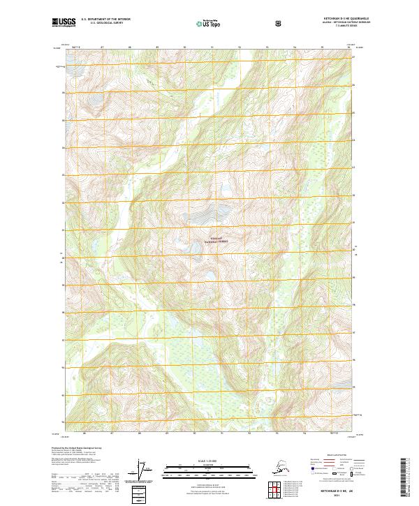
2021 Map of Ketchikan D-3 NE
USGS Topo · Published 2021About this map
Leduc River and the Chickamin River carve through the steep elevations of this portion of the Tongass National Forest. The landscape is defined by its dramatic hydrography, where glacial-fed waters and small tributaries like Indian Cr drain through deep valleys. This 2021 survey illustrates a wilderness nearly devoid of human infrastructure, with no roads or settlements recorded. Instead, the map detail focuses on the complex topography and extensive wetlands that characterize the river bottoms. For the environmental researcher or local historian, the map provides a precise record of the river courses and drainage patterns as they existed in the early 21st century, set against the backdrop of one of the nation's most significant protected forest regions.
Find a feature on this map
8 named features on this map. Tap any name to fly to it.
Don’t see what you’re looking for? This feature index may not catch every label — zoom into the map to look around manually.
Map Details
Editions of this 2021 Ketchikan D-3 NE Map
This is the sole edition of this map. No revisions or reprints were ever made.
Other maps of this area

1951 · Bradfield Canal
USGS Topo · 1:250,000

1952 · Ketchikan
USGS Topo · 1:250,000

1954 · Bradfield Canal
USGS Topo · 1:250,000

1955 · Ketchikan D-2
USGS Topo · 1:63,360

1955 · Bradfield canal A-2
USGS Topo · 1:63,360

1955 · Ketchikan D-3
USGS Topo · 1:63,360

1955 · Bradfield canal A-3
USGS Topo · 1:63,360

1955 · Ketchikan
USGS Topo · 1:250,000

1955 · Bradfield Canal
USGS Topo · 1:250,000
1996 · Ketchikan D-3
USGS Topo · 1:63,360