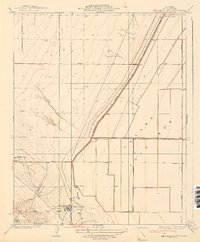
1937 Map of Kettleman City
USGS Topo · Published 1937About this map
Kettleman City and the emerging industrial footprint of the Kings County oil fields define this mid-1930s landscape. The map captures a critical transition as the dry expanse of the Tulare Lake Bed meets the rugged eastern slopes of the Kettleman Hills. Settlement patterns here are dominated by large-scale agricultural and petroleum interests, evidenced by the West Tulare Land Co and the cluster of activity around Milham City.
Find a feature on this map
17 named features on this map. Tap any name to fly to it.
Don’t see what you’re looking for? This feature index may not catch every label — zoom into the map to look around manually.
Map Details
Editions of this 1937 Kettleman City Map
3 editions found
Other maps of this area

1912 · Coalinga
USGS Topo · 1:125,000

1914 · Lost Hills
USGS Topo · 1:125,000

1914 · Cholame
USGS Topo · 1:125,000

1915 · Cholame
USGS Topo · 1:125,000

1917 · Cholame
USGS Topo · 1:125,000

1929 · Stratford
USGS Topo · 1:31,680

1929 · Westhaven
USGS Topo · 1:31,680

1930 · Discovery Well
USGS Topo · 1:31,680

1930 · Kettleman Plain
USGS Topo · 1:31,680

1930 · Middle Dome
USGS Topo · 1:31,680