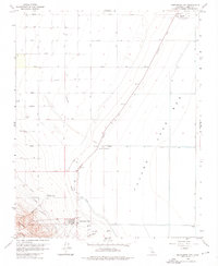
1963 Map of Kettleman City
USGS Topo · Published 1976About this map
Kettleman City sits at the edge of the sprawling Tulare Lake Bed, a landscape defined by industrial water management and the burgeoning petroleum economy of the early 1960s. The terrain transitions sharply from the alluvial deposits of the dry lake bed to the rising elevations of the Kettleman Hills, where a dense network of pipelines and the Kettleman Hills Compressor Station reflect the region's energy infrastructure. Water distribution is the primary driver of development here, illustrated by the presence of the Blakeley Canal, the Aqueduct, and a large Siphon. Agricultural operations like West Tulare Lands Ranch and West Lake Farms are established along the valley floor, supported by numerous wells. A strictly alphabetical grid of rural roads, including Newton Ave and Quebec Ave, segments the landscape, while the Landing Strip and Arroyo Robador mark the diverse uses of this Kings County terrain.
Find a feature on this map
34 named features on this map. Tap any name to fly to it.
Don’t see what you’re looking for? This feature index may not catch every label — zoom into the map to look around manually.
Map Details
Editions of this 1963 Kettleman City Map
4 editions found
Other maps of this area

1912 · Coalinga
USGS Topo · 1:125,000

1914 · Lost Hills
USGS Topo · 1:125,000

1914 · Cholame
USGS Topo · 1:125,000

1915 · Cholame
USGS Topo · 1:125,000

1917 · Cholame
USGS Topo · 1:125,000

1929 · Stratford
USGS Topo · 1:31,680

1929 · Westhaven
USGS Topo · 1:31,680

1930 · Discovery Well
USGS Topo · 1:31,680

1930 · Kettleman Plain
USGS Topo · 1:31,680

1930 · Middle Dome
USGS Topo · 1:31,680