
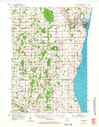
1954 Map of Kewaunee
USGS Topo · Published 1956About this map
The Kewaunee River winds through the northern portion of this lakeshore landscape, meeting Lake Michigan at the port of Kewaunee. The mid-1950s terrain is marked by a dense network of rural schoolhouses and churches that served the small farming communities across the county line between Kewaunee Co and Manitowoc Co. Several of these landmarks are noted as already out of use by this time, including High Bluff Sch and Phillip Sch.
Find a feature on this map
67 named features on this map. Tap any name to fly to it.
Don’t see what you’re looking for? This feature index may not catch every label — zoom into the map to look around manually.
Map Details
Editions of this 1954 Kewaunee Map
2 editions found
Other maps of this area

1952 · Casco
USGS Topo · 1:62,500

1954 · Manitowoc
USGS Topo · 1:62,500

1954 · Denmark
USGS Topo · 1:62,500

1954 · New Franken
USGS Topo · 1:62,500

1954 · Reedsville
USGS Topo · 1:62,500

1954 · Manitowoc
USGS Topo · 1:250,000

1958 · Manitowoc
USGS Topo · 1:250,000

1960 · Algoma
USGS Topo · 1:62,500

1978 · Casco
USGS Topo · 1:24,000

1978 · Denmark
USGS Topo · 1:24,000