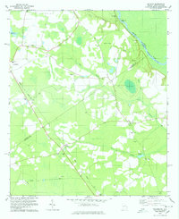
1978 Map of Kildare
USGS Topo · Published 1978About this map
Savannah River defines the eastern boundary of this Georgia and South Carolina borderland, where the Central of Georgia line cuts a diagonal path through the landscape. This 1970s survey documents a rural topography characterized by numerous cypress-laden drainages like Ferry Branch and Devils Branch, alongside distinctive local landmarks like the Tiger Leap Bluff. The map provides significant detail for genealogists, recording several country churches and their associated burying grounds, including St Peters Ch, Mizpah Ch, and Bethel Ch. Settlement patterns are concentrated around small nodes such as Kildare, Leola, and Newington, while the river lowlands are marked by historical access points like Hudson Ferry Landing and Eneck Landing. The presence of several bays and ponds, such as Eneck Bay and Wilsons Pond, illustrates the hydrology of the coastal plain before modern development altered these wetlands.
Find a feature on this map
38 named features on this map. Tap any name to fly to it.
Don’t see what you’re looking for? This feature index may not catch every label — zoom into the map to look around manually.
Map Details
Editions of this 1978 Kildare Map
This is the sole edition of this map. No revisions or reprints were ever made.
Other maps of this area

1918 · Oliver
USGS Topo · 1:62,500

1919 · Shirley
USGS Topo · 1:62,500

1919 · Egypt
USGS Topo · 1:62,500

1920 · Oliver
USGS Topo · 1:62,500

1921 · Brooklet
USGS Topo · 1:62,500

1939 · Egypt
USGS Topo · 1:62,500

1943 · Brooklet
USGS Topo · 1:62,500

1943 · Egypt
USGS Topo · 1:62,500

1943 · Shirley
USGS Topo · 1:62,500

1943 · Millen
USGS Topo · 1:125,000