
1968 Map of Kildare
USGS Topo · Published 1970About this map
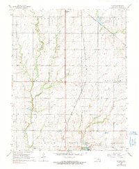
Kildare sits at the heart of this North Central Oklahoma landscape, a small settlement defined by its position along the Atchison Topeka and Santa Fe railroad line. During the late 1960s, the region's economy was clearly driven by the Northwest Kildare Oil and Gas Field, which spans across the western sections of the map. This industrial presence contrasts with the rural community centers like Pleasant View Sch, which served as a focal point for the surrounding farms.
Find a feature on this map
27 named features on this map. Tap any name to fly to it.
Don’t see what you’re looking for? This feature index may not catch every label — zoom into the map to look around manually.
Map Details
Editions of this 1968 Kildare Map
2 editions found
Other maps of this area

1935 · Kaw
USGS Topo · 1:62,500

1936 · Belford
USGS Topo · 1:62,500

1955 · Enid
USGS Topo · 1:250,000

1958 · Enid
USGS Topo · 1:250,000

1963 · Charley Creek
USGS Topo · 1:24,000

1963 · Uncas
USGS Topo · 1:24,000

1963 · Kaw City NW
USGS Topo · 1:24,000

1968 · Ponca City NW
USGS Topo · 1:24,000
1968 · Newkirk
USGS Topo · 1:24,000
1968 · Newkirk SW
USGS Topo · 1:24,000