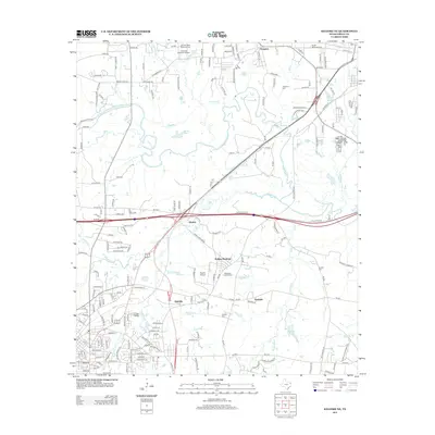
2013 Map of Kilgore NE
USGS Topo · Published 2013About this map
The Sabine River winds through the heart of this East Texas corridor, shaping a landscape defined by expansive floodplains and a series of oxbow features like Moss Lake and Mud Lake. This area north of Kilgore represents a complex intersection of historical rural settlements and modern regional infrastructure. Early community roots are visible through numerous burial grounds such as Utzman Cem and Grable Cem, while the southern portion of the map shows the more densely developed environs of Danville and the campus of Kilgore Coll.
Find a feature on this map
198 named features on this map. Tap any name to fly to it.
Don’t see what you’re looking for? This feature index may not catch every label — zoom into the map to look around manually.
Map Details
Editions of this 2013 Kilgore NE Map
This is the sole edition of this map. No revisions or reprints were ever made.
Other maps of this area

1936 · Kilgore
USGS Topo · 1:48,000

1940 · Kilgore
USGS Topo · 1:62,500

1956 · Tyler
USGS Topo · 1:250,000

1958 · Tatum
USGS Topo · 1:62,500

1960 · White Oak
USGS Topo · 1:24,000

1960 · Gladewater
USGS Topo · 1:24,000

1962 · Longview Heights
USGS Topo · 1:24,000

1971 · Kilgore NE
USGS Topo · 1:24,000
1971 · Kilgore SW
USGS Topo · 1:24,000
1971 · Kilgore NW
USGS Topo · 1:24,000