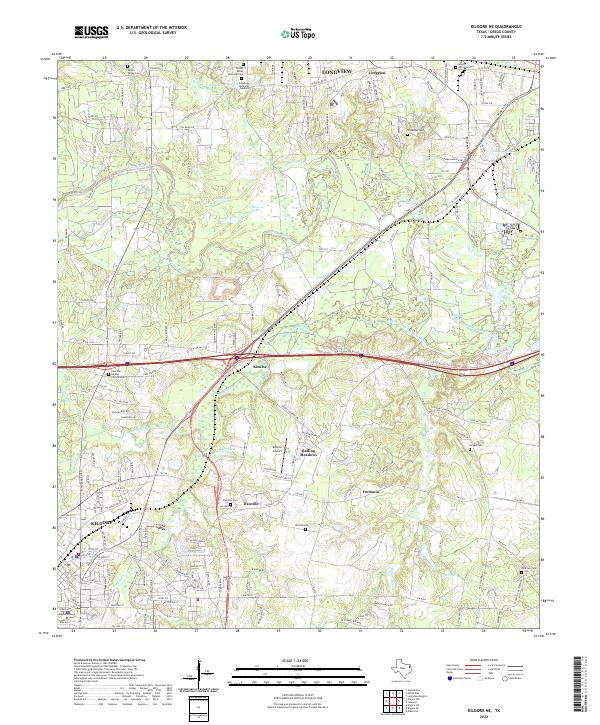
2022 Map of Kilgore NE
USGS Topo · Published 2022About this map
The Sabine River snakes through the heart of Gregg County, Texas, defining a landscape where the urban fringes of Longview and Kilgore meet rural timber and oil-rich lands. This 2022 survey captures the transition from the city blocks of Greggton to the outlying settlements of Danville and Fredonia. The density of cemeteries, including the historic Danville Cem, Utzman Cem, and the remote Peatown Cem to the southeast, offers a clear record of early East Texas community centers that predated the modern sprawl.
Find a feature on this map
149 named features on this map. Tap any name to fly to it.
Don’t see what you’re looking for? This feature index may not catch every label — zoom into the map to look around manually.
Map Details
Editions of this 2022 Kilgore NE Map
This is the sole edition of this map. No revisions or reprints were ever made.
Other maps of this area

1936 · Kilgore
USGS Topo · 1:48,000

1940 · Kilgore
USGS Topo · 1:62,500

1956 · Tyler
USGS Topo · 1:250,000

1958 · Tatum
USGS Topo · 1:62,500

1960 · White Oak
USGS Topo · 1:24,000

1960 · Gladewater
USGS Topo · 1:24,000

1962 · Longview Heights
USGS Topo · 1:24,000

1971 · Kilgore NE
USGS Topo · 1:24,000
1971 · Kilgore SW
USGS Topo · 1:24,000
1971 · Kilgore NW
USGS Topo · 1:24,000