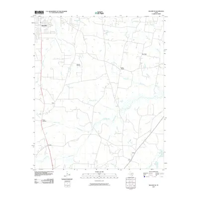
2010 Map of Kilgore SE
USGS Topo · Published 2010About this map
Holland Mountain rises as a prominent landmark in this East Texas landscape, which is characterized by a dense network of watercourses including Bighead Creek, Tiawichi Creek, and Bacon Creek. The area south of Kilgore is dotted with small rural communities and junctions that speak to the region's settlement patterns, such as Pirtle, Pitner Junction, and Cross Roads. The presence of Crims Chapel and various family-named features like Jacobs and Craig provide valuable points of reference for those researching local family history or land use in Gregg County. Numerous branches and bayous, including Wynns Bayou and Sheffield Branch, feed into the larger creek systems, while man-made features like Martin Lake and Johnson Lake further define the local hydrology near the New Hope community.
Find a feature on this map
29 named features on this map. Tap any name to fly to it.
Don’t see what you’re looking for? This feature index may not catch every label — zoom into the map to look around manually.
Map Details
Editions of this 2010 Kilgore SE Map
This is the sole edition of this map. No revisions or reprints were ever made.
Other maps of this area

1935 · Henderson
USGS Topo · 1:48,000

1936 · Kilgore
USGS Topo · 1:48,000

1939 · Henderson
USGS Topo · 1:62,500

1940 · Kilgore
USGS Topo · 1:62,500

1956 · Tyler
USGS Topo · 1:250,000

1958 · Tatum
USGS Topo · 1:62,500

1960 · Minden
USGS Topo · 1:62,500

1971 · Kilgore NE
USGS Topo · 1:24,000
1971 · Kilgore SW
USGS Topo · 1:24,000
1971 · Kilgore NW
USGS Topo · 1:24,000