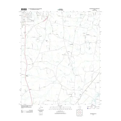
2013 Map of Kilgore SE
USGS Topo · Published 2013About this map
Pirtle and Pitner Junction anchor this part of East Texas, where the landscape is defined by a dense network of creeks and small bayous flowing toward the Sabine River basin. The terrain rises slightly at Holland Mtn, providing a modest elevation change in an area otherwise characterized by water features like Martin Lake and Johnson Lake. A web of county roads and established state routes connects several small communities, including New Hope, Cross Roads, and Craig, showing the persistent settlement patterns of Gregg and Rusk counties.
Find a feature on this map
110 named features on this map. Tap any name to fly to it.
Don’t see what you’re looking for? This feature index may not catch every label — zoom into the map to look around manually.
Map Details
Editions of this 2013 Kilgore SE Map
This is the sole edition of this map. No revisions or reprints were ever made.
Other maps of this area

1935 · Henderson
USGS Topo · 1:48,000

1936 · Kilgore
USGS Topo · 1:48,000

1939 · Henderson
USGS Topo · 1:62,500

1940 · Kilgore
USGS Topo · 1:62,500

1956 · Tyler
USGS Topo · 1:250,000

1958 · Tatum
USGS Topo · 1:62,500

1960 · Minden
USGS Topo · 1:62,500

1971 · Kilgore NE
USGS Topo · 1:24,000
1971 · Kilgore SW
USGS Topo · 1:24,000
1971 · Kilgore NW
USGS Topo · 1:24,000