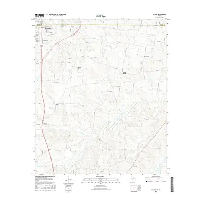
2016 Map of Kilgore SE
USGS Topo · Published 2016About this map
The southeastern outskirts of Kilgore unfold across the Gregg Co and Rusk Co line in this 2016 survey, showing the transition from the city's residential streets into the timbered creek bottoms of East Texas. The landscape is defined by a dense network of watercourses, including the westward-flowing Tiawichi Cr and the northward reach of Bacon Cr, which feed into various wetlands and larger bodies like Johnson Lake. Small rural communities and crossroads, such as Pirtle, Cross Roads, and New Hope, remain identifiable via the county road system, preserving the heritage of the region's older settlement patterns.
Find a feature on this map
112 named features on this map. Tap any name to fly to it.
Don’t see what you’re looking for? This feature index may not catch every label — zoom into the map to look around manually.
Map Details
Editions of this 2016 Kilgore SE Map
This is the sole edition of this map. No revisions or reprints were ever made.
Other maps of this area

1935 · Henderson
USGS Topo · 1:48,000

1936 · Kilgore
USGS Topo · 1:48,000

1939 · Henderson
USGS Topo · 1:62,500

1940 · Kilgore
USGS Topo · 1:62,500

1956 · Tyler
USGS Topo · 1:250,000

1958 · Tatum
USGS Topo · 1:62,500

1960 · Minden
USGS Topo · 1:62,500

1971 · Kilgore NE
USGS Topo · 1:24,000
1971 · Kilgore SW
USGS Topo · 1:24,000
1971 · Kilgore NW
USGS Topo · 1:24,000