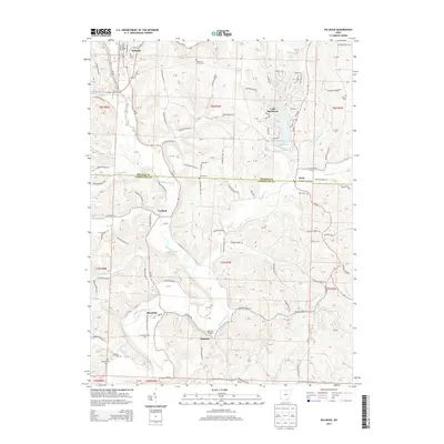
2013 Map of Killbuck
USGS Topo · Published 2013About this map
Killbuck serves as the primary hub in this corner of Holmes County, situated where Killbuck Creek meets Wolf Cr. The landscape transitions from the developed streets of the village into a more rural character defined by tight valleys and numerous small runs. To the south, the village of Blissfield and the nearby Helmick area illustrate the region's historic rural settlement patterns, joined by the crossing at Helmick Bridge. Significant genealogical resources are scattered throughout the quadrangle, including the Oakhill Cem near the northern boundary and the Weatherwax Cem to the southwest. The presence of Lake Buckhorn with its complex network of residential drives like Zermatt St and Interlaken Dr highlights a distinct pocket of modern development contrasted against the older, linear farm roads like Township Road 79.
Find a feature on this map
127 named features on this map. Tap any name to fly to it.
Don’t see what you’re looking for? This feature index may not catch every label — zoom into the map to look around manually.
Map Details
Editions of this 2013 Killbuck Map
This is the sole edition of this map. No revisions or reprints were ever made.
Other maps of this area

1912 · Loudonville
USGS Topo · 1:62,500

1913 · Brinkhaven
USGS Topo · 1:62,500

1913 · Coshocton
USGS Topo · 1:62,500

1914 · Loudonville
USGS Topo · 1:62,500

1915 · Brinkhaven
USGS Topo · 1:62,500

1915 · Millersburg
USGS Topo · 1:62,500

1915 · Coshocton
USGS Topo · 1:62,500

1943 · Millersburg
USGS Topo · 1:62,500

1943 · Coshocton
USGS Topo · 1:62,500

1943 · Loudonville
USGS Topo · 1:62,500