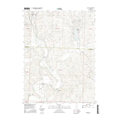
2016 Map of Killbuck
USGS Topo · Published 2016About this map
Killbuck Creek winds through the central valley of this landscape, forming a natural corridor for the settlements of Killbuck, Layland, and Blissfield. The map reveals a transition from the village center of Killbuck in the north to the more dispersed hamlets of Helmick and Clark further south. A notable concentration of cemeteries, including Oakhill Cem, Salem Cem, and Blissfield Cem, provides valuable points of interest for genealogists tracing local families in both Holmes and Coshocton Counties.
Find a feature on this map
127 named features on this map. Tap any name to fly to it.
Don’t see what you’re looking for? This feature index may not catch every label — zoom into the map to look around manually.
Map Details
Editions of this 2016 Killbuck Map
This is the sole edition of this map. No revisions or reprints were ever made.
Other maps of this area

1912 · Loudonville
USGS Topo · 1:62,500

1913 · Brinkhaven
USGS Topo · 1:62,500

1913 · Coshocton
USGS Topo · 1:62,500

1914 · Loudonville
USGS Topo · 1:62,500

1915 · Brinkhaven
USGS Topo · 1:62,500

1915 · Millersburg
USGS Topo · 1:62,500

1915 · Coshocton
USGS Topo · 1:62,500

1943 · Millersburg
USGS Topo · 1:62,500

1943 · Coshocton
USGS Topo · 1:62,500

1943 · Loudonville
USGS Topo · 1:62,500