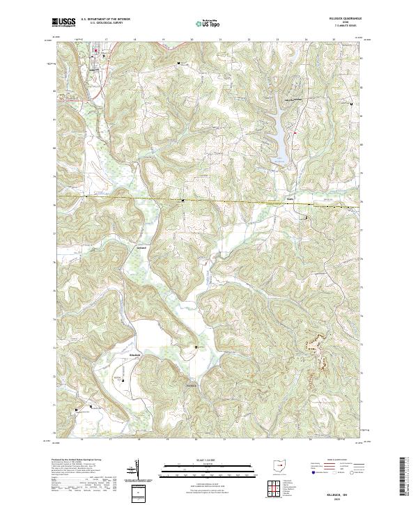
2023 Map of Killbuck
USGS Topo · Published 2023About this map
Killbuck Creek dominates the drainage of this central Ohio landscape, winding through a valley that connects several small crossroads communities including Killbuck, Layland, and Blissfield. The topography reveals a complex network of runs and creeks, such as Hoagland Run and Doughty Creek, that have carved the terrain into distinct ridges and hollows. Transport is defined by the W & Le Rr corridor following the main waterway, supporting the village centers while rural township roads like TWP RD 324 and TWP HWY 71 reach into the upland areas.
Find a feature on this map
89 named features on this map. Tap any name to fly to it.
Don’t see what you’re looking for? This feature index may not catch every label — zoom into the map to look around manually.
Map Details
Editions of this 2023 Killbuck Map
This is the sole edition of this map. No revisions or reprints were ever made.
Other maps of this area

1912 · Loudonville
USGS Topo · 1:62,500

1913 · Brinkhaven
USGS Topo · 1:62,500

1913 · Coshocton
USGS Topo · 1:62,500

1914 · Loudonville
USGS Topo · 1:62,500

1915 · Brinkhaven
USGS Topo · 1:62,500

1915 · Millersburg
USGS Topo · 1:62,500

1915 · Coshocton
USGS Topo · 1:62,500

1943 · Millersburg
USGS Topo · 1:62,500

1943 · Coshocton
USGS Topo · 1:62,500

1943 · Loudonville
USGS Topo · 1:62,500