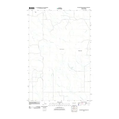
2011 Map of Killdeer Mountains
USGS Topo · Published 2011About this map
Medicine Hole stands as a prominent landmark within the Killdeer Mountains in this section of western North Dakota. The landscape is defined by a dense network of watercourses, including Spring Creek, Gumbo Creek, and Norred Creek, which carve through the high ground. To the northwest, Skunk Hill provides an additional high point overlooking the drainages of Petes Creek and Chase Creek. The map shows a transition toward a more regular grid of rural roads such as Main St and 1st St SW in the southeastern portion, contrasting with the more irregular topography of the mountains themselves. This 2011 survey captures a landscape where traditional geographic features like Jim Creek meet modern county road designations, providing a clear view of the area's physical and administrative layout.
Find a feature on this map
20 named features on this map. Tap any name to fly to it.
Don’t see what you’re looking for? This feature index may not catch every label — zoom into the map to look around manually.
Map Details
Editions of this 2011 Killdeer Mountains Map
This is the sole edition of this map. No revisions or reprints were ever made.
Other maps of this area

1953 · Watford City
USGS Topo · 1:250,000

1957 · Watford City
USGS Topo · 1:250,000

1958 · Lone Butte SE
USGS Topo · 1:24,000

1958 · North Killdeer Mountain
USGS Topo · 1:24,000

1967 · Watford City
USGS Topo · 1:250,000

1970 · Lost Bridge
USGS Topo · 1:24,000

1974 · Killdeer
USGS Topo · 1:100,000

1974 · Petes Creek
USGS Topo · 1:24,000

1974 · Fayette
USGS Topo · 1:24,000
1974 · Killdeer
USGS Topo · 1:24,000