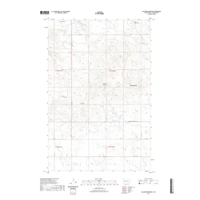
2020 Map of Killdeer Mountains
USGS Topo · Published 2020About this map
Medicine Hole sits as a prominent landmark within the high terrain of the Killdeer Mountains in Dunn County. This western North Dakota landscape is defined by its significant relief, including North Killdeer Mtn and Skunk Hill, which tower over the surrounding plains. The drainage pattern is complex, with several watercourses like Norred Cr, Petes Cr, and Spring Cr carving through the breaks.
Find a feature on this map
23 named features on this map. Tap any name to fly to it.
Don’t see what you’re looking for? This feature index may not catch every label — zoom into the map to look around manually.
Map Details
Editions of this 2020 Killdeer Mountains Map
This is the sole edition of this map. No revisions or reprints were ever made.
Other maps of this area

1953 · Watford City
USGS Topo · 1:250,000

1957 · Watford City
USGS Topo · 1:250,000

1958 · Lone Butte SE
USGS Topo · 1:24,000

1958 · North Killdeer Mountain
USGS Topo · 1:24,000

1967 · Watford City
USGS Topo · 1:250,000

1970 · Lost Bridge
USGS Topo · 1:24,000

1974 · Killdeer
USGS Topo · 1:100,000

1974 · Petes Creek
USGS Topo · 1:24,000

1974 · Fayette
USGS Topo · 1:24,000
1974 · Killdeer
USGS Topo · 1:24,000