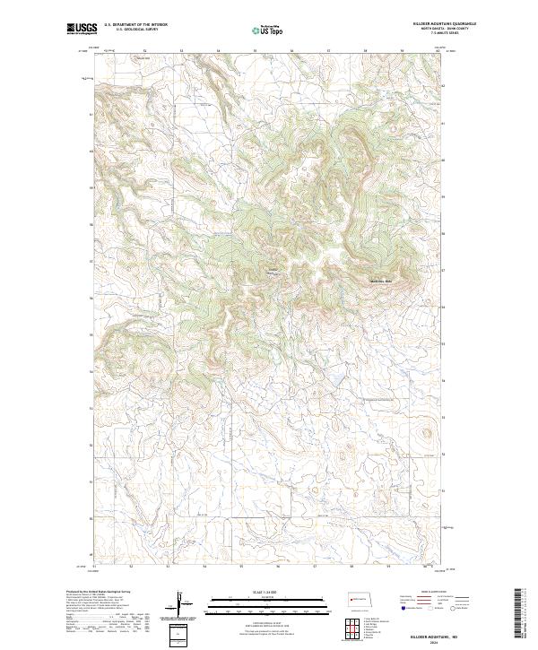
2024 Map of Killdeer Mountains
USGS Topo · Published 2024About this map
The Killdeer Mountains rise sharply in this part of Dunn County, presenting a landscape of high plateaus and deep coulees. This topographical study highlights the significant cultural and natural landmark of Medicine Hole, located on the eastern slopes. The southern portion of the map is marked by the historical trace of Killdeer Mt Battlefield Rd, orienting the viewer toward the site of a major conflict between the U.S. Army and the Sioux in 1864.
Find a feature on this map
17 named features on this map. Tap any name to fly to it.
Don’t see what you’re looking for? This feature index may not catch every label — zoom into the map to look around manually.
Map Details
Editions of this 2024 Killdeer Mountains Map
This is the sole edition of this map. No revisions or reprints were ever made.
Other maps of this area

1953 · Watford City
USGS Topo · 1:250,000

1957 · Watford City
USGS Topo · 1:250,000

1958 · Lone Butte SE
USGS Topo · 1:24,000

1958 · North Killdeer Mountain
USGS Topo · 1:24,000

1967 · Watford City
USGS Topo · 1:250,000

1970 · Lost Bridge
USGS Topo · 1:24,000

1974 · Killdeer
USGS Topo · 1:100,000

1974 · Petes Creek
USGS Topo · 1:24,000

1974 · Fayette
USGS Topo · 1:24,000
1974 · Killdeer
USGS Topo · 1:24,000