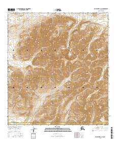
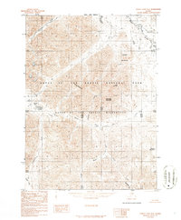
2016 Map of Killik River A-1 SW
USGS Topo · Published 2016About this map
Gates of the Arctic National Park dominates this northern Alaskan interior landscape, where the Brooks Range transitions into the North Slope. The terrain is defined by the high elevations of Papik Mtn and the intricate drainage networks of Suluak Cr and Suluagiak Cr. These watercourses flow through a region marked by significant elevation changes, captured here by the U.S. Geological Survey with 40-foot contour intervals. This survey also documents the administrative boundary of the North Slope Borough Yukon-Koyukuk Census Area, illustrating the intersection of federally protected wilderness and local jurisdictional limits in a roadless portion of the Arctic.
Find a feature on this map
11 named features on this map. Tap any name to fly to it.
Don’t see what you’re looking for? This feature index may not catch every label — zoom into the map to look around manually.
Map Details
Editions of this 2016 Killik River A-1 SW Map
This is the sole edition of this map. No revisions or reprints were ever made.
Other maps of this area

1951 · Survey Pass
USGS Topo · 1:250,000

1951 · Killik River
USGS Topo · 1:250,000

1956 · Survey Pass
USGS Topo · 1:250,000

1956 · Killik River
USGS Topo · 1:250,000

1964 · Survey Pass
USGS Topo · 1:250,000

1966 · Survey Pass
USGS Topo · 1:250,000
1986 · Killik River A-2
USGS Topo · 1:63,360
1986 · Killik River A-1
USGS Topo · 1:63,360
1986 · Survey Pass D-1
USGS Topo · 1:63,360
1986 · Survey Pass D-2
USGS Topo · 1:63,360