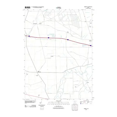
2010 Map of Kimball
USGS Topo · Published 2010About this map
Bloomingville and North Monroeville anchor this portion of the northern Ohio landscape, characterized by a complex drainage network that reflects generations of agricultural land management. Numerous named ditches, such as Sherer Ditch, Schlessman Ditch, and Zorn Beutal Ditch, carve a geometric pattern across the terrain, feeding into larger systems like Pipe Creek and the meandering West Branch Huron River. This 2010 survey highlights the rural infrastructure of the region, from the Zorn Acres Airport in the northeast to the Erf Family Farms further south. Genealogists and local historians will find significant value in the distribution of burial sites, including Saint Johns Cemetery, Oxford Lutheran Cemetery, and Ruggles Cemetery, which dot the intersections of long-established country roads like Patton Tract Rd and Mason Rd.
Find a feature on this map
60 named features on this map. Tap any name to fly to it.
Don’t see what you’re looking for? This feature index may not catch every label — zoom into the map to look around manually.
Map Details
Editions of this 2010 Kimball Map
This is the sole edition of this map. No revisions or reprints were ever made.
Other maps of this area

1901 · Bellevue
USGS Topo · 1:62,500

1903 · Bellevue
USGS Topo · 1:62,500

1904 · Sandusky
USGS Topo · 1:62,500

1915 · Norwalk
USGS Topo · 1:62,500

1915 · Siam
USGS Topo · 1:62,500

1944 · Norwalk
USGS Topo · 1:62,500

1956 · Toledo
USGS Topo · 1:250,000

1959 · Kimball
USGS Topo · 1:24,000

1959 · Milan
USGS Topo · 1:24,000

1959 · Sandusky
USGS Topo · 1:24,000