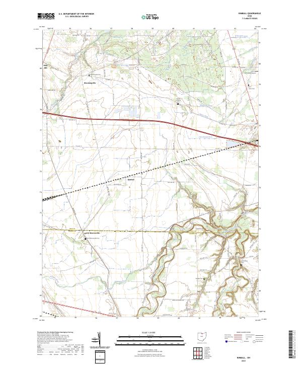
2023 Map of Kimball
USGS Topo · Published 2023About this map
Bloomingville and Kimball anchor this landscape where the agricultural plains of northern Ohio meet the complex drainage systems of the Huron River. The map reveals a transition from the well-defined upland settlements to the intricate, meandering path of the West Branch Huron River and the East Branch Huron River in the south. This area is characterized by a high density of small family and community burial grounds, including the Bloomingville Cem, Oxford Lutheran Cem, and the more remote Jacobsburg Cem near the river bluffs.
Find a feature on this map
83 named features on this map. Tap any name to fly to it.
Don’t see what you’re looking for? This feature index may not catch every label — zoom into the map to look around manually.
Map Details
Editions of this 2023 Kimball Map
This is the sole edition of this map. No revisions or reprints were ever made.
Other maps of this area

1901 · Bellevue
USGS Topo · 1:62,500

1903 · Bellevue
USGS Topo · 1:62,500

1904 · Sandusky
USGS Topo · 1:62,500

1915 · Norwalk
USGS Topo · 1:62,500

1915 · Siam
USGS Topo · 1:62,500

1944 · Norwalk
USGS Topo · 1:62,500

1956 · Toledo
USGS Topo · 1:250,000

1959 · Kimball
USGS Topo · 1:24,000

1959 · Milan
USGS Topo · 1:24,000

1959 · Sandusky
USGS Topo · 1:24,000