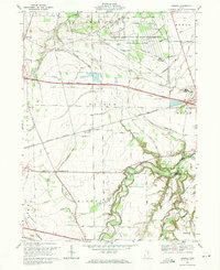
1969 Map of Kimball
USGS Topo · Published 1971About this map
The National Aeronautics and Space Administration Lewis Research Center occupies a significant portion of the northern landscape in this 1969 revision, indicating the area's strategic importance during the late-century aerospace era. This scientific facility is bordered by traditional Erie County agricultural lands and small settlements like Bloomingville and Kimball. To the south, the winding course of the Huron River dominates the topography, carving through the terrain near the Milan State Wildlife Area. This map documents a crossroads of infrastructure, where the Ohio Turnpike and the Norfolk and Western railway intersect the rural grid. For genealogists, the sheet preserves the location of St Johns Ch and St Johns Cem, alongside family-named routes such as Beutal Road and Webb Settlement Road, providing a clear view of the settlement patterns between North Monroeville and the edge of Monroeville.
Find a feature on this map
64 named features on this map. Tap any name to fly to it.
Don’t see what you’re looking for? This feature index may not catch every label — zoom into the map to look around manually.
Map Details
Editions of this 1969 Kimball Map
This is the sole edition of this map. No revisions or reprints were ever made.
Other maps of this area

1901 · Bellevue
USGS Topo · 1:62,500

1903 · Bellevue
USGS Topo · 1:62,500

1904 · Sandusky
USGS Topo · 1:62,500

1915 · Norwalk
USGS Topo · 1:62,500

1915 · Siam
USGS Topo · 1:62,500

1944 · Norwalk
USGS Topo · 1:62,500

1956 · Toledo
USGS Topo · 1:250,000

1959 · Kimball
USGS Topo · 1:24,000

1959 · Milan
USGS Topo · 1:24,000

1959 · Sandusky
USGS Topo · 1:24,000