
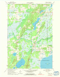
1970 Map of Kimberly
USGS Topo · Published 1972About this map
The Rice River and its associated wetlands dominate this Aitkin County landscape, defining the boundaries of the Rice Lake National Wildlife Refuge and the Kimberly State Wildlife Management Area. The settlement of Kimberly serves as a small hub along the Burlington Northern railroad, which cuts across the central terrain. This 1970 field-checked survey reveals a complex hydrological network where the Portage Branch feeds into larger bodies like Portage Lake and Rice Lake. For genealogists and local historians, the map documents significant community landmarks including Fleming Ch in the north and the Lansford Cem and Saron Cem sites. The presence of an Old Railroad Grade running parallel to the active line provides a clear look at the evolution of regional transport infrastructure before modern developments further altered these marshy lowlands.
Find a feature on this map
28 named features on this map. Tap any name to fly to it.
Don’t see what you’re looking for? This feature index may not catch every label — zoom into the map to look around manually.
Map Details
Editions of this 1970 Kimberly Map
2 editions found
Other maps of this area

1914 · Aitkin
USGS Topo · 1:62,500

1915 · Aitkin
USGS Topo · 1:62,500

1916 · Wealthwood
USGS Topo · 1:62,500

1953 · Duluth
USGS Topo · 1:250,000

1958 · Duluth
USGS Topo · 1:250,000

1969 · Thor NE
USGS Topo · 1:24,000

1969 · Thor
USGS Topo · 1:24,000

1970 · Mc Gregor
USGS Topo · 1:24,000

1970 · Palisade
USGS Topo · 1:24,000
1970 · Minnewawa
USGS Topo · 1:24,000