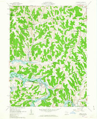
1962 Map of Kimbolton
USGS Topo · Published 1963About this map
Kimbolton and the surrounding Guernsey County countryside are defined here by the winding waters of the Wills Creek Reservoir, an area within the Muskingum Watershed Conservancy District subject to controlled inundation. The early 1960s landscape shows a transition between traditional agricultural life and industrial activity, evidenced by the presence of a Strip Mine and scattered Gas Wells or Oil Wells.
Find a feature on this map
36 named features on this map. Tap any name to fly to it.
Don’t see what you’re looking for? This feature index may not catch every label — zoom into the map to look around manually.
Map Details
Editions of this 1962 Kimbolton Map
Other maps of this area

1909 · Antrim
USGS Topo · 1:48,000

1909 · Uhrichsville
USGS Topo · 1:62,500

1909 · Cambridge
USGS Topo · 1:62,500

1911 · Antrim
USGS Topo · 1:62,500

1911 · Uhrichsville
USGS Topo · 1:62,500

1911 · Newcomerstown
USGS Topo · 1:62,500

1912 · Cambridge
USGS Topo · 1:62,500

1913 · Newcomerstown
USGS Topo · 1:62,500

1943 · Newcomerstown
USGS Topo · 1:62,500

1951 · Canton
USGS Topo · 1:250,000