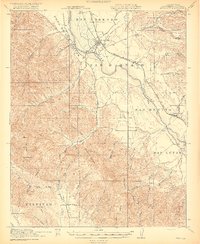
1919 Map of King City
USGS Topo · Published 1919About this map
King City serves as the focal point of this 1917–1918 survey, situated along the Salinas River where the Southern Pacific railroad's Coast Line dictates the valley's development. The landscape is defined by vast Spanish land grants, including San Lorenzo (Soberanes) and Milpitas (Pastor), reflecting a transition from traditional ranching to rail-based commerce. To the south, the historic San Antonio Mission stands at the edge of the survey area, while the rugged interior is carved by a network of family-named canyons such as Thompson Canyon and Robinson Canyon. A well-distributed system of rural education is visible through several district buildings, including Oasis School, Sweetwater School, and Alberto School. The map also captures specialized waypoints like the Goat Camp and the settlement of San Lucas, illustrating the distribution of agricultural outposts and small rail stops before modern highway expansion.
Find a feature on this map
62 named features on this map. Tap any name to fly to it.
Don’t see what you’re looking for? This feature index may not catch every label — zoom into the map to look around manually.
Map Details
Editions of this 1919 King City Map
4 editions found
Other maps of this area

1912 · San Ardo
USGS Topo · 1:31,680

1912 · Metz
USGS Topo · 1:31,680

1915 · Soledad
USGS Topo · 1:62,500

1915 · Priest Valley
USGS Topo · 1:125,000

1919 · King City
USGS Topo · 1:62,500

1919 · Junipero Serra
USGS Topo · 1:62,500

1919 · Bryson
USGS Topo · 1:62,500

1919 · Bradley
USGS Topo · 1:62,500

1921 · Cape San Martin
USGS Topo · 1:62,500

1921 · Metz
USGS Topo · 1:62,500