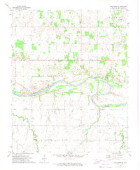
1972 Map of Kingfisher NE
USGS Topo · Published 1974About this map
The Cimarron River winds through this central Oklahoma landscape, defining the transition between the townships of Banner and Excelsior. During the early 1970s, the region was characterized by its active Oil Field development and agricultural infrastructure. Local community centers are anchored by several rural institutions, including Booker T Washington Sch and Big Four Sch, alongside several country churches like Oak Grove Ch and Banner Ch. The map provides significant genealogical value through its many small burial grounds, such as Lincoln Cem and Bird Creek Cem. Transportation across the river is highlighted by the Gould Bridge, while the surrounding terrain is drained by numerous tributaries like Bird Creek and Turkey Creek. This survey captures the rural character of the area before modern expansion, preserving the locations of family-named landmarks and local gravel operations.
Find a feature on this map
26 named features on this map. Tap any name to fly to it.
Don’t see what you’re looking for? This feature index may not catch every label — zoom into the map to look around manually.
Map Details
Editions of this 1972 Kingfisher NE Map
This is the sole edition of this map. No revisions or reprints were ever made.
Other maps of this area

1892 · Kingfisher
USGS Topo · 1:125,000

1893 · Lovell
USGS Topo · 1:62,500

1893 · Hennessey
USGS Topo · 1:62,500

1895 · Kingfisher
USGS Topo · 1:125,000

1954 · Oklahoma City
USGS Topo · 1:250,000

1955 · Enid
USGS Topo · 1:250,000

1956 · Hennessey
USGS Topo · 1:62,500

1957 · Oklahoma City
USGS Topo · 1:250,000

1958 · Enid
USGS Topo · 1:250,000

1963 · Oklahoma City
USGS Topo · 1:250,000