
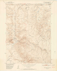
1952 Map of Kings Canyon
USGS Topo · Published 1952About this map
Village Belle Mine and the Kings Canyon Mine sit at the heart of this 1952 topographic study, marking an era of industrial transition in North Park. The landscape is defined by the steep drainage systems of the Medicine Bow Range, where waters flow from high ridges into Pinkham Creek and Kings Canyon Creek. Small clusters of human activity are centered around the Union Pacific rail corridor, featuring the settlements of Camp Nelson, Clayton Park, and Bluebird Park. The survey meticulously details the intersection of three different national forests — the Routt, Medicine Bow, and Roosevelt — and the state line where Colorado meets Wyoming. Mineral extraction history is visible in the form of multiple abandoned mine shafts and inactive operations, illustrating the waning days of earlier mining booms.
Find a feature on this map
35 named features on this map. Tap any name to fly to it.
Don’t see what you’re looking for? This feature index may not catch every label — zoom into the map to look around manually.
Map Details
Editions of this 1952 Kings Canyon Map
2 editions found
Other maps of this area

1906 · Medicine Bow
USGS Topo · 1:125,000

1908 · Medicine Bow
USGS Topo · 1:125,000

1950 · Northgate
USGS Topo · 1:24,000

1950 · Kings Canyon
USGS Topo · 1:24,000

1952 · Northgate
USGS Topo · 1:24,000

1954 · Rawlins
USGS Topo · 1:250,000

1954 · Craig
USGS Topo · 1:250,000

1955 · Old Roach
USGS Topo · 1:24,000

1955 · Eagle Hill
USGS Topo · 1:24,000

1955 · Shipman Mountain
USGS Topo · 1:24,000