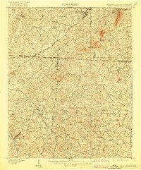
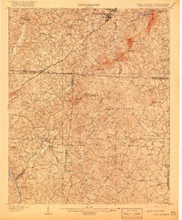
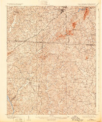
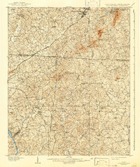
1908 Map of Kings Mountain
USGS Topo · Published 1919About this map
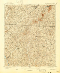
The Kings Mountain Battleground serves as the historical anchor for this early twentieth-century survey, which documents the complex terrain and settlement patterns along the border of North Carolina and South Carolina. This region, spanning parts of Cleveland and Gaston counties in the north and York County to the south, is characterized by prominent peaks like The Pinnacle, Henry Knob, and Joes Mtn. The map records a landscape transitioning into a more connected era, with the Southern RR and the Carolina and Northwestern railroad lines cutting through the hills.
Find a feature on this map
65 named features on this map. Tap any name to fly to it.
Don’t see what you’re looking for? This feature index may not catch every label — zoom into the map to look around manually.
Map Details
Editions of this 1908 Kings Mountain Map
6 editions found
Other maps of this area

1906 · Kings Mountain
USGS Topo · 1:62,500

1907 · Sharon
USGS Topo · 1:62,500

1908 · Kings Mountain
USGS Topo · 1:62,500

1909 · Gaffney
USGS Topo · 1:62,500

1909 · Lincolnton
USGS Topo · 1:62,500

1911 · Lincolnton
USGS Topo · 1:62,500

1914 · Gastonia
USGS Topo · 1:48,000

1916 · Gastonia
USGS Topo · 1:62,500

1941 · Spartanburg
USGS Topo · 1:250,000

1947 · Clover
USGS Topo · 1:62,500