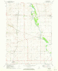
1971 Map of Kings
USGS Topo · Published 1973About this map
Davis Junction serves as the primary rail hub on this 1970s landscape, marking the intersection of the Chicago Milwaukee St Paul and Pacific and the Chicago and North Western railroads. This network supported a string of rural settlements across the northern Illinois prairie, including Monroe Center, Holcomb, and Lindenwood. The terrain is characterized by the winding path of Killbuck Creek and prominent local landmarks like Big Mound. Genealogists will find several distinct burial sites such as Big Mound Cem and Killbuck Cem, alongside community features like the Townhall in Lynnville and the White Rock Center. The map also captures the local agricultural economy through a dense grid of named country roads, including Mowers Road and Royster Rd, which connect the scattered farmsteads and small crossroads communities.
Find a feature on this map
48 named features on this map. Tap any name to fly to it.
Don’t see what you’re looking for? This feature index may not catch every label — zoom into the map to look around manually.
Map Details
Editions of this 1971 Kings Map
2 editions found
Other maps of this area

1917 · Kings
USGS Topo · 1:62,500

1918 · Kings
USGS Topo · 1:62,500

1918 · Kirkland
USGS Topo · 1:62,500

1934 · De Kalb
USGS Topo · 1:62,500

1937 · De Kalb
USGS Topo · 1:62,500

1949 · Camp Grant
USGS Topo · 1:24,000

1952 · Rochelle
USGS Topo · 1:62,500

1954 · Rockford
USGS Topo · 1:250,000

1955 · Rockford
USGS Topo · 1:250,000

1958 · Aurora
USGS Topo · 1:250,000