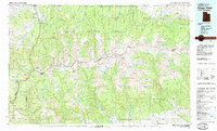
1982 Map of Kings Peak
USGS Topo · Published 1985About this map
The highest point in Utah, Kings Peak, anchors this 1982 study of the Uinta Mountains, where the high-altitude landscape is defined by vast tracts of protected land within the Wasatch National Forest and Ashley National Forest. This era shows a complex hydrological network managed for storage and irrigation, including the Meeks Cabin Reservoir and Moon Lake, which sit alongside countless natural water bodies like Grandaddy Lake and Island Lake.
Find a feature on this map
52 named features on this map. Tap any name to fly to it.
Don’t see what you’re looking for? This feature index may not catch every label — zoom into the map to look around manually.
Map Details
Editions of this 1982 Kings Peak Map
2 editions found
Other maps of this area

1885 · Salt Lake
USGS Topo · 1:250,000

1885 · Ashley
USGS Topo · 1:250,000

1885 · Uinta
USGS Topo · 1:250,000

1900 · Coalville
USGS Topo · 1:125,000

1901 · Hayden Peak
USGS Topo · 1:125,000

1903 · Hayden Peak
USGS Topo · 1:125,000

1903 · Coalville
USGS Topo · 1:125,000

1905 · Gilbert Peak
USGS Topo · 1:125,000

1906 · Gilbert Peak
USGS Topo · 1:125,000

1906 · Marsh Peak
USGS Topo · 1:125,000
Featured Places
- Moon Lake Resort, UT
- Christmas Meadow Summer Homes, UT
- Moon Lake Lodge, UT
- Sweetwater County, WY
- Summit County, UT