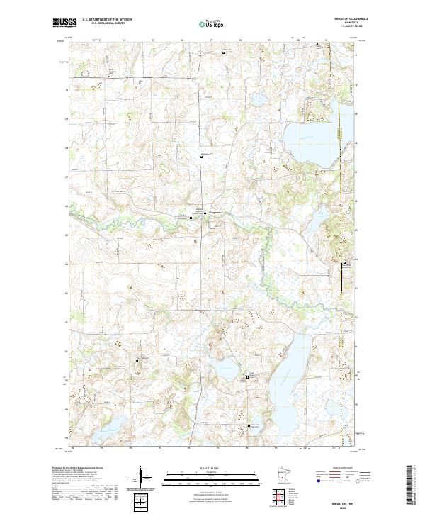
2022 Map of Kingston
USGS Topo · Published 2022About this map
Kingston serves as a central hub on the Meeker and Wright County line, situated where the North Fork Crow River snakes through the glacial landscape. This region is remarkably dense with burial sites, many associated with early congregational life such as the Kingston Apostolic Lutheran Cem and the French Lake Mission Cem. The terrain is characterized by a complex network of wetlands and water bodies, including Lake Arvilla and Maynard Lake, which are interconnected by drainages like Washington Cr and Judicial Ditch Number Two. The township grid system is well-defined by numerous county roads like Co RD 27 and Co RD 24, reflecting a long-established agricultural pattern. For family historians, the high concentration of small cemeteries like Talbot Cem and Swan Lake Cem provides specific points for tracing local lineages in this corner of Minnesota.
Find a feature on this map
54 named features on this map. Tap any name to fly to it.
Don’t see what you’re looking for? This feature index may not catch every label — zoom into the map to look around manually.
Map Details
Editions of this 2022 Kingston Map
This is the sole edition of this map. No revisions or reprints were ever made.
Other maps of this area

1951 · Annandale
USGS Topo · 1:62,500

1953 · Saint Cloud
USGS Topo · 1:250,000

1957 · Saint Cloud
USGS Topo · 1:250,000

1958 · Saint Cloud
USGS Topo · 1:250,000

1958 · Dassel
USGS Topo · 1:62,500

1958 · Cokato
USGS Topo · 1:62,500

1967 · Watkins
USGS Topo · 1:24,000

1967 · Kimball
USGS Topo · 1:24,000
1974 · South Haven
USGS Topo · 1:24,000
1982 · Dassel
USGS Topo · 1:24,000