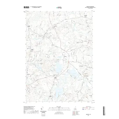
2021 Map of Kingston
USGS Topo · Published 2021About this map
Kingston and its surrounding Rockingham County villages are defined by a complex network of glacial ponds and slow-moving river systems. The town center sits between the shores of Greenwood Pond and Great Pond, while the Powwow River drains south toward Powwow Pond and Country Pond. This modern survey reveals a landscape where historical burial grounds are remarkably dense, ranging from the central Greenwood Cemetery and Pine Grove Cemetery to smaller, family-named sites like Dudley Cemetery near Marshall Corner and Sanborn Cemetery in Brentwood. The map provides a clear look at how 21st-century residential growth in communities like East Kingston and West Kingston has integrated with ancient natural features like Spruce Swamp and the Exeter River. Notable landmarks such as Winterwood Airport and the historic Ye Old Cemetery in Danville further highlight the layered heritage of the region.
Find a feature on this map
159 named features on this map. Tap any name to fly to it.
Don’t see what you’re looking for? This feature index may not catch every label — zoom into the map to look around manually.
Map Details
Editions of this 2021 Kingston Map
This is the sole edition of this map. No revisions or reprints were ever made.
Other maps of this area

1888 · Newburyport
USGS Topo · 1:62,500

1888 · Haverhill
USGS Topo · 1:62,500

1890 · Haverhill
USGS Topo · 1:62,500

1890 · Newburyport
USGS Topo · 1:62,500

1893 · Dover
USGS Topo · 1:62,500

1893 · Haverhill
USGS Topo · 1:62,500

1894 · Newburyport
USGS Topo · 1:62,500

1916 · Dover
USGS Topo · 1:62,500

1917 · Mt. Pawtuckaway
USGS Topo · 1:62,500

1918 · Dover
USGS Topo · 1:62,500