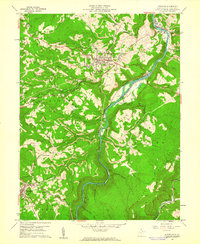
1960 Map of Kingwood
USGS Topo · Published 1961About this map
The Cheat River carves a deep valley through the heart of Preston County, defining a landscape where industrial extraction meets organized military presence at the National Guard Camp Dawson. During the early 1960s, the hilltop seat of Kingwood served as a central hub, flanked by the active corridors of the Baltimore and Ohio and the West Virginia Northern railroads. The map reveals an intensive history of resource use, with numerous Strip Mines and quarries dotting the ridges above settlements like Albright and Tunnelton. Local genealogy is well-preserved through a network of rural landmarks, including St Josephs Ch and Irona Ch, alongside family-named burial grounds like the Miller Cem and Wilson Cem. Small hamlets such as Irona, Manown, and Preston are shown connected by winding roads and industrial infrastructure, including a prominent pipeline traversing the eastern hills toward the Briery Mountains.
Find a feature on this map
57 named features on this map. Tap any name to fly to it.
Don’t see what you’re looking for? This feature index may not catch every label — zoom into the map to look around manually.
Map Details
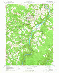
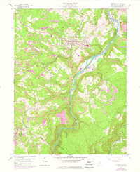
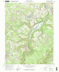
Editions of this 1960 Kingwood Map
4 editions found
Other maps of this area

1886 · St. George
USGS Topo · 1:125,000

1891 · St. George
USGS Topo · 1:125,000

1902 · Morgantown
USGS Topo · 1:62,500

1904 · Bruceton
USGS Topo · 1:62,500

1907 · Thornton
USGS Topo · 1:62,500

1907 · Kingwood
USGS Topo · 1:62,500

1925 · Kingwood
USGS Topo · 1:62,500

1925 · Morgantown
USGS Topo · 1:62,500

1926 · Thornton
USGS Topo · 1:62,500

1926 · Bruceton
USGS Topo · 1:62,500