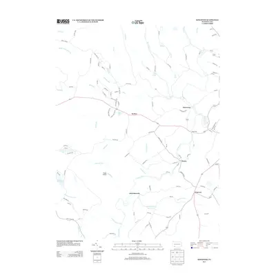
2013 Map of Kingwood
USGS Topo · Published 2013About this map
Laurel Hill Cr meanders through this section of Somerset County, connecting several small rural settlements that define the local geography. The map shows the established hamlets of Scullton, Barronvale, Metzler, and Kingwood, each situated near the network of creeks and runs that carve through the landscape. Named family routes like Earl Ansell Rd and John Henry Rd suggest a deep-rooted local history, while natural features such as Cole Run Falls and Blue Hole Spring point to the area's geological character. Several distinct water bodies, including Lake Pyle and Clairton Lake, are interspersed among the drainages of Sandy Run and Whipkey Run. The settlement of Schweibinzville remains a notable point of reference in the central valley, illustrating the traditional rural spacing of these Pennsylvania communities.
Find a feature on this map
104 named features on this map. Tap any name to fly to it.
Don’t see what you’re looking for? This feature index may not catch every label — zoom into the map to look around manually.
Map Details
Editions of this 2013 Kingwood Map
This is the sole edition of this map. No revisions or reprints were ever made.
Other maps of this area

1913 · Somerset
USGS Topo · 1:62,500

1915 · Somerset
USGS Topo · 1:62,500

1921 · Meyersdale
USGS Topo · 1:62,500

1922 · Confluence
USGS Topo · 1:62,500

1922 · Donegal
USGS Topo · 1:62,500

1931 · Confluence
USGS Topo · 1:62,500

1933 · Confluence
USGS Topo · 1:62,500

1935 · Donegal
USGS Topo · 1:62,500

1939 · Meyersdale
USGS Topo · 1:62,500

1944 · Somerset
USGS Topo · 1:62,500
Featured Places
- Lower Turkeyfoot Township, PA
- Upper Turkeyfoot Township, PA
- Springfield Township, PA
- Schweibinzville, Upper Turkeyfoot Township
- Kingwood, Upper Turkeyfoot Township