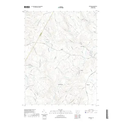
2019 Map of Kingwood
USGS Topo · Published 2019About this map
Laurel Hill Creek winds through this section of the Laurel Highlands, defining a landscape of deep hollows and high ridges along the Fayette and Somerset county line. Small residential clusters like Scullton, Barronvale, and Schweinbinzville are connected by a network of rural roads such as Scullton Rd and Kingwood Rd. The area is notably characterized by its water features, including the cascades of Cole Run Falls and the secluded Blue Hole Spring. The Potomac Heritage National Scenic Trail traverses the western high ground of Laurel Hill, following the ridgeline past Flugey Hollow. This survey captures the rural character of these Pennsylvania townships, where land use is dictated by the steep topography of features like Twins Mountain and the drainage patterns of numerous creeks such as Whipkey Run and Cranberry Glade Run. Local landmarks like Clayton Lake and Lake Pyle provide small points of interest within the broader wooded terrain.
Find a feature on this map
88 named features on this map. Tap any name to fly to it.
Don’t see what you’re looking for? This feature index may not catch every label — zoom into the map to look around manually.
Map Details
Editions of this 2019 Kingwood Map
This is the sole edition of this map. No revisions or reprints were ever made.
Other maps of this area

1913 · Somerset
USGS Topo · 1:62,500

1915 · Somerset
USGS Topo · 1:62,500

1921 · Meyersdale
USGS Topo · 1:62,500

1922 · Confluence
USGS Topo · 1:62,500

1922 · Donegal
USGS Topo · 1:62,500

1931 · Confluence
USGS Topo · 1:62,500

1933 · Confluence
USGS Topo · 1:62,500

1935 · Donegal
USGS Topo · 1:62,500

1939 · Meyersdale
USGS Topo · 1:62,500

1944 · Somerset
USGS Topo · 1:62,500
Featured Places
- Lower Turkeyfoot Township, PA
- Upper Turkeyfoot Township, PA
- Springfield Township, PA
- Schweibinzville, Upper Turkeyfoot Township
- Kingwood, Upper Turkeyfoot Township