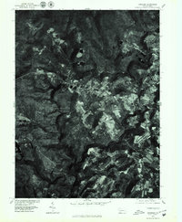
1977 Map of Kingwood
USGS Topo · Published 1979About this map
Laurel Hill Creek winds through this Somerset County landscape, carving a deep valley that separates the agricultural plateaus of the late 1970s. The orthophoto format provides a unique photographic record of the patchwork of farm fields and dense forest cover characteristic of Laurel Hill. Small rural settlements like Kingwood and Barronvale serve as focal points for the surrounding countryside, while Scullion sits near the heart of the clearing. The presence of Clairton Lake and Cranberry Glade Lake highlights the managed water resources of the era, situated amidst the steep, wooded terrain. This 1977 aerial perspective captures the region before further modern development, showing the exact footprint of farmsteads and timberlines during the bicentennial era.
Find a feature on this map
7 named features on this map. Tap any name to fly to it.
Don’t see what you’re looking for? This feature index may not catch every label — zoom into the map to look around manually.
Map Details
Editions of this 1977 Kingwood Map
This is the sole edition of this map. No revisions or reprints were ever made.
Other maps of this area

1913 · Somerset
USGS Topo · 1:62,500

1915 · Somerset
USGS Topo · 1:62,500

1921 · Meyersdale
USGS Topo · 1:62,500

1922 · Confluence
USGS Topo · 1:62,500

1922 · Donegal
USGS Topo · 1:62,500

1931 · Confluence
USGS Topo · 1:62,500

1933 · Confluence
USGS Topo · 1:62,500

1935 · Donegal
USGS Topo · 1:62,500

1939 · Meyersdale
USGS Topo · 1:62,500

1944 · Somerset
USGS Topo · 1:62,500
Featured Places
- Springfield Township, PA
- Saltlick Township, PA
- Upper Turkeyfoot Township, PA
- Lower Turkeyfoot Township, PA
- Metzler, Upper Turkeyfoot Township