
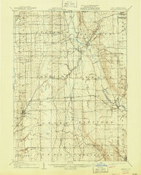
1907 Map of Kinsman
USGS Topo · Published 1940About this map
Pymatuning Creek and the Shenango River carve through the agricultural landscape of eastern Trumbull County in this early twentieth-century survey. The terrain is defined by a dense network of township lines and small rail-centered settlements, reflecting the peak of the rural railroad era before modern highway expansion. Significant hubs like Kinsman and Cortland serve as anchors, while smaller stations such as Farmdale PO Kinsman Sta and Nutwood Fowler Sta illustrate the vital link between local post offices and rail transit.
Find a feature on this map
56 named features on this map. Tap any name to fly to it.
Don’t see what you’re looking for? This feature index may not catch every label — zoom into the map to look around manually.
Map Details
Editions of this 1907 Kinsman Map
2 editions found
Other maps of this area

1905 · Andover
USGS Topo · 1:48,000

1905 · Bristolville
USGS Topo · 1:62,500

1905 · Jefferson
USGS Topo · 1:62,500

1905 · Neshannock
USGS Topo · 1:62,500

1906 · Linesville
USGS Topo · 1:62,500

1906 · Youngstown
USGS Topo · 1:62,500

1907 · Andover
USGS Topo · 1:62,500

1907 · Neshannock
USGS Topo · 1:62,500

1907 · Bristolville
USGS Topo · 1:62,500

1907 · Jefferson
USGS Topo · 1:62,500