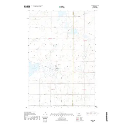
2020 Map of Kintyre
USGS Topo · Published 2020About this map
Kintyre occupies a central position within this portion of Emmons County, situated just south of the Kintyre Cem. The landscape is defined by the prairie potholes and terminal moraine topography characteristic of the region, evidenced by the numerous small wetlands and larger bodies like Stink Lake and Goose Lake. This 2020 update shows the local road network organized on a strict grid of section lines, including 22nd Ave SE and 59th St SE, which facilitate access across the agricultural terrain. The village layout is modest, centered on Main Ave N and 1st St, with Cold Spring Ln branching to the west. This representation provides a clear view of the rural infrastructure and land management patterns in Tell Township during the early twenty-first century.
Find a feature on this map
26 named features on this map. Tap any name to fly to it.
Don’t see what you’re looking for? This feature index may not catch every label — zoom into the map to look around manually.
Map Details
Editions of this 2020 Kintyre Map
This is the sole edition of this map. No revisions or reprints were ever made.
Other maps of this area

1953 · Jamestown
USGS Topo · 1:250,000

1954 · Bismarck
USGS Topo · 1:250,000

1956 · Jamestown
USGS Topo · 1:250,000

1958 · Bismarck
USGS Topo · 1:250,000

1975 · Linton NE
USGS Topo · 1:24,000

1975 · Braddock
USGS Topo · 1:24,000
1975 · Braddock NE
USGS Topo · 1:24,000

1975 · Kintyre
USGS Topo · 1:24,000

1979 · Bismarck
USGS Topo · 1:100,000

1979 · Kintyre NE
USGS Topo · 1:24,000