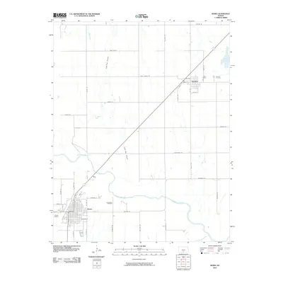
2010 Map of Kiowa
USGS Topo · Published 2010About this map
The Medicine Lodge River winds across this southern Kansas landscape, anchoring a region defined by agricultural plots and canyon breaks. The city of Kiowa serves as the primary hub in the southwest corner, showing a detailed street grid including Main St, Coates St, and Hardtner St. Local history and genealogy are preserved at Riverview Cemetery just east of town and Rosehill Cemetery near the community of Hazelton in the northeast. The terrain transitions from flat farmland to the more complex geography of Lone Tree Canyon and Black Kettle. Notable transportation features include the Kiowa Airport and an extensive network of named rural routes such as Rattlesnake Trl and Driftwood Rd, which connect the disparate homesteads and natural water sources like Spicer Lake.
Find a feature on this map
41 named features on this map. Tap any name to fly to it.
Don’t see what you’re looking for? This feature index may not catch every label — zoom into the map to look around manually.
Map Details
Editions of this 2010 Kiowa Map
This is the sole edition of this map. No revisions or reprints were ever made.
Other maps of this area

1889 · Anthony
USGS Topo · 1:125,000

1891 · Medicine Lodge
USGS Topo · 1:125,000

1891 · Anthony
USGS Topo · 1:125,000

1893 · Medicine Lodge
USGS Topo · 1:125,000

1955 · Woodward
USGS Topo · 1:250,000

1955 · Pratt
USGS Topo · 1:250,000

1958 · Woodward
USGS Topo · 1:250,000

1959 · Pratt
USGS Topo · 1:250,000

1968 · Capron
USGS Topo · 1:24,000

1969 · Amorita
USGS Topo · 1:24,000