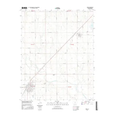
2016 Map of Kiowa
USGS Topo · Published 2016About this map
The Medicine Lodge River winds through the southern reaches of this landscape, anchoring the settlement of Kiowa, where a dense grid of streets like Main St, Chatham St, and Miller St reflects its role as a regional hub. To the northeast, the smaller community of Hazelton sits near the headwaters of Salty Cr and Spicer Lake, serving as a secondary focal point for the surrounding prairie. The terrain is marked by the prominent Lone Tree Canyon and a network of section-line roads and named paths such as Rattlesnake Trl and Black Kettle. Genealogists will find particular value in the locations of Riverview Cem near the river and Rosehill Cem on the outskirts of Hazelton. This survey documents the intersection of rural agriculture and small-town life in southern Kansas, preserving the exact layout of streets and land divisions.
Find a feature on this map
36 named features on this map. Tap any name to fly to it.
Don’t see what you’re looking for? This feature index may not catch every label — zoom into the map to look around manually.
Map Details
Editions of this 2016 Kiowa Map
This is the sole edition of this map. No revisions or reprints were ever made.
Other maps of this area

1889 · Anthony
USGS Topo · 1:125,000

1891 · Medicine Lodge
USGS Topo · 1:125,000

1891 · Anthony
USGS Topo · 1:125,000

1893 · Medicine Lodge
USGS Topo · 1:125,000

1955 · Woodward
USGS Topo · 1:250,000

1955 · Pratt
USGS Topo · 1:250,000

1958 · Woodward
USGS Topo · 1:250,000

1959 · Pratt
USGS Topo · 1:250,000

1968 · Capron
USGS Topo · 1:24,000

1969 · Amorita
USGS Topo · 1:24,000